

The mountains are calling! One of the treats of owning or renting an RV is going shade-bathing in the forest at your own pace and convenience. It might even be the reason why you wanted an RV in the first place, which is a pretty good reason if you ask me.
What are the best rocky mountain RV trips? The best rocky mountain RV trips are those within US National Parks- Mt. Ida in RMNP, Mts. Thielsen and Bailey in Crater Lake, Mt. Healy and Sugarloaf Ridge in Denali, and Mt. Clark in Yosemite. Mts. Whitney and Elbert are also on the list. All these mountains have great RV campsites near them.
Below are eight of the best rocky mountain RV destinations from my research. I’ve even included RV campgrounds that are near these mountains and the amenities available for each one.
Mount Ida, Colorado
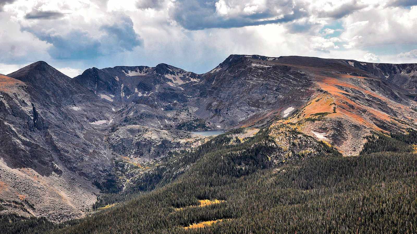
Mount Ida is a mountain summit in the northern front range of the rocky mountains of Colorado. This 12,874-foot peak is located inside the Rocky Mountain National Park Wilderness. The mountain was probably named after Mount Ida on Crete. Mount Ida means ‘the Mountain of the Goddess’ and for good reason.
This mountain gives you great panoramic views from an awesome trail, especially because most of the trail goes above the treeline. The trail then creates a nice vantage point for those 180-degree photographs. With that said, a great clearing isn’t good for inclement weather, so be careful and watch the weather.
This trail, though fairly an easy one, can be an extremely windy endeavor. For this, a little planning is needed. Bring windbreakers, some warm sweat-wicking clothes, and plenty of water. Be prepared for some snowfields when hiking in June, a little Christmas in July theme going on here.
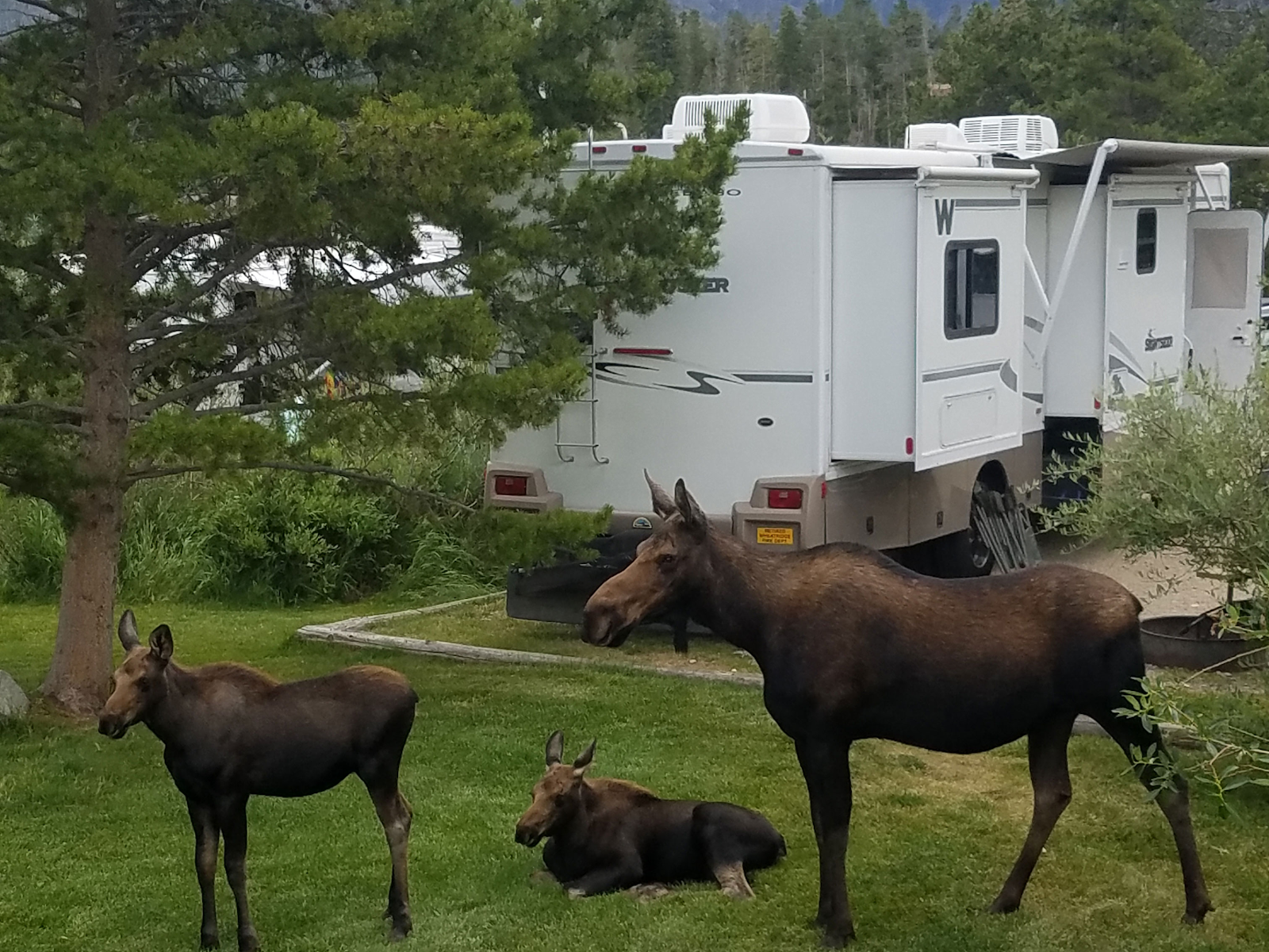
It’s essential to bring a nice camera for taking pictures of the mountains and wildlife. Since this is protected land, there are lots of chances to see wildlife here like marmots, pikas, bighorn sheep, and elk! Hiking usually takes six hours to complete the trail using the Milner Pass trailhead.
This hike is one of a high altitude hike. The trail rides quickly and there will be altitude changes, so be ready because your ears will pop. The best time to visit Mt. Ida is during the summer when the weather is nice, usually late April to early July or early August to early October.
RV Park Near It: Elk Creek Campground and RV Park
At only a 30-minute drive from Milner Pass is the Elk Creek Campground and RV Park. This campground has your basic amenities- free Wi-Fi, free parking, water, and electricity hookups- plus a lot more! It has a fish pond not far from the RV parking spaces for you to enjoy a little fishing fun. It also has a decent golf course, if you want to relax and strike a few putts here and there.
While it is kid-friendly and pet friendly, it still has a bar where you can kick back and loosen up. They have one of the cleanest bathrooms and showers ever for commercial standards. They also have a laundry service available. The order of this information is just coincidental. Not that you’d need a clean bathroom and laundry service after visiting the bar, no, this is a wholesome kid-friendly place. Let’s keep it that way.
Kidding aside, this is a great place to park in when going for a hike at Mt. Ida. If you, by chance, be lucky, moose and other wildlife are often spotted at this picturesque campsite. The adventure begins at the campsite.
Mount Thielsen, or Big Cowhorn, Oregon
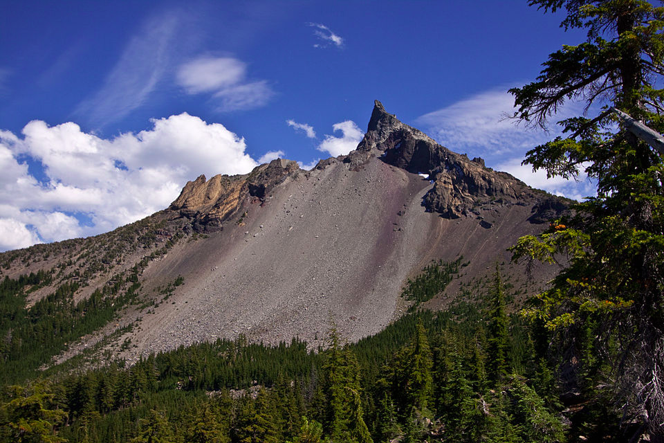
Mount Thielsen, wittingly called Big Cowhorn, is actually an extinct shield volcano in Oregon High Cascade. At first glance, I honestly couldn’t appreciate why it’s called ‘Big Cowhorn’ since it’s just one tall peak and a cow horn comes in pairs. That is until I stumble across a ‘Little Cowhorn’ peak near it. Both peaks were capped with dramatic spires that resembled the horns of a cow. Anyway, those were the old names, these days, the peak is famously called Mount Thielsen.
This magnificent peak near Mount Bailey was a volcano with an eruptive activity that ceased 250,000 years ago. Through the years, glaciers have heavily eroded the volcano’s structure. This event created precipitous slopes that look like steeples and a horn-like peak. This spire-like shape of Mount Thielsen attracts lightning strikes and creates fulgurite, a beautiful mineral shaped naturally like tubes, clumps, or masses of sintered sand, rock, and organic debris formed when lightning discharges to ground. It isn’t called ‘The Lightning Rod of the Cascades’ for nothing!
There are primarily three things worth doing in Mount Thielsen- hiking, rock climbing, and skiing. The trail that takes you to the summit takes about an hour or more to hike. Mount Thielsen is over 2,799 meters tall and some parts of the trail are steep. The final approach to the summit could be a little daunting since it goes through a narrow slot in the rock, but it is doable. The exposure at the top is dramatic and the view is such a reward.
The best time to visit Mount Thielsen for a hike is during the months of July to September. Knowing that this beautiful spire attracts lightning, make sure you check the weather forecast before visiting. We wouldn’t want to encounter any thunderstorm in a lightning magnet, especially since the summit is way above the treeline.
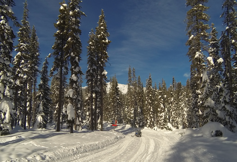
The spires also make for a great ski descent, although the summit pinnacle itself is not skiable. The best month to visit this beauty for skiing is in February, just before the break of Spring. The hike up to the decent skiable parts can take you up to three miles uphill. It will all be worth it when you are rewarded with an awesome panoramic view of Diamond Peak then a nice ski terrain downhill to top the trip off.
Mount Bailey, Oregon
Mount Bailey is Mount Thielsen’s relatively younger tephra cone and shield volcano sister in Oregon’s Cascade Range. It is located on the opposite side of Diamond Lake from Mount Thielsen in southern Oregon. Mount Bailey consists of a 610 meter-high main cone on top of an old basaltic-andesite shield volcano. Mount Bailey is slightly smaller than the near Diamond Peak. It may not stand the tallest, but Mount Bailey provides a great summer trail and transforms into a haven for skiing in the winter months.
The mountain’s transportation, instead of a conventional chairlift, is provided by snowcats— tractor-like vehicles that can go up Mount Bailey’s steep, snow-covered slopes and carry skiers to the higher reaches of the mountain. That beats Mt. Thielsen’s three mile climb for a ski slope. In the summer months, a scenic five mile hiking trail gives access to Bailey’s summit.
If you want a more historic insight on Mount Bailey, Native Americans are said to be the first climbers of the extinct volcano. Their spiritual leaders held feasts and prayer vigils on the mountain’s summit. It is easy to understand why since climbing this mountain lets you commune with nature.
The best time to visit this wonder is from July to September when you have fair weather. This time of the year brings out amazing views of vistas all around. For skiing, the best months to be on the slopes are from January to February.
While You’re There: An Insight on Crater Lake National Park, Oregon
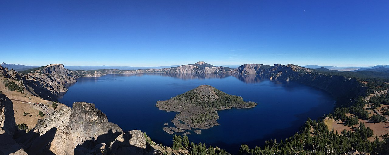
The thing is, the whole area of Crater Lake National Park is such a scenic treat. The National Park encompasses Crater Lake, which is a lake in the remnant of a destroyed volcano. A few trails are in the area and Cleatwood Cove Trail is one of the most popular trails therein. Cleatwood Cove trail leads you down to the lake and is the only trail that leads to the part where it is safe to swim in. Remember that this lake is quite a deep and irregular one since it is a caldera of a now extinct volcano so not all parts are okay to swim in.
Watchman’s trail, in contrast, is a trail that takes you to the highest climbing point. Since this trail goes up to the clearing, it offers the best view in the area. Aside from Mount Bailey and Mount Thielsen, one prominent landmark in the national park is the Wizard Island- the wizard’s hat-shaped island in the middle of crater lake- so magical.
Although it is not impossible to swim to Wizard Island, as a few people have in this century, it is more practical to take the available boat tours. After docking on the foot of the cinder cone, you have the option to have a half-day hike, a three-hour hike, or a full day stay, depending on your drop-off point.
RV Resort Near Mounts Bailey and Thielsen: Diamond Lake Resort and RV Park
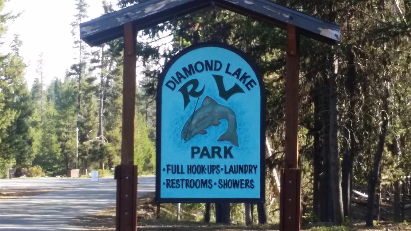
Just 20 minutes from the Crater Lake National Park is the Diamond Lake Resort and RV Park. This rustic 1920s resort with its log cabins on the shores of Diamond Lake is nine miles from the National Park and 11 miles from Mt. Bailey- the closest resort in the area.
It has complete basic amenities of free parking, free Wi-Fi, and the usual electricity and water RV hookups. It is kid-friendly, pet-friendly, and it has a breakfast buffet!
Since Diamond Lake Resort and Diamond Lake RV Park have merged, RV guests can now enjoy the marina, boat, paddleboard, and kayak rentals in the area. A cafe, restaurant, and souvenir store are also available.
RV Park Near Mounts Bailey and Thielsen: Mazama Campground
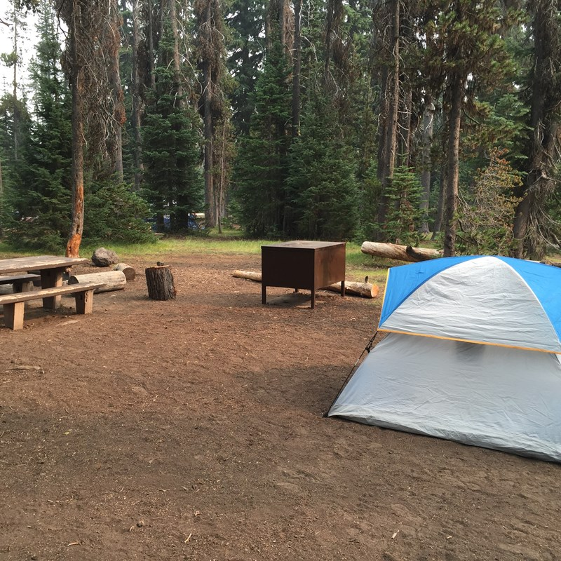
Mazama Campground is an RV park and tent-pitch campsite located seven miles from the south of Rim Village in Crater Lake National Park. Due to harsh winters, the campground is only open in the summer.
According to the national park service website entry for the campground, ‘in June, sites are available only on a first-come, first-served basis. In July, August, and September, 75% of the sites can be reserved in advance, either online or by calling their landline. The other 25% are first-come, first-served. In July and August, the campground usually fills up by mid-afternoon.’
The campgrounds do have the basic amenities- clean showers, restrooms, and laundry service. They also charge $43 for full hookups, $37 for just electricity hookups, and $32 if you just want to camp in and use no hookups. This kid-friendly RV park also has fire rings and picnic tables for building those perfect family picnic memories.
Do remember that the national forest surrounding the park has campgrounds, too. Sleeping here overnight and backyard camping is legal and is free but a permit is required.
Mount Healy, Alaska
Mount Healy is only one of the numerous majestic mountains in Denali. Hiking up Denali or ‘the high one’ is a life-threatening endeavor. Almost half the hikers do not reach its summit. Knowing that, it’s a safer choice to hike more surmountable mountains.
Even though it’s not as deadly as the main Denali trail, the trail in Mount Healy is one of the steepest trails in the Denali area. The trail rises steadily through a spruce forest at first for a distance of 2.7 miles uphill. This takes the hikers around two hours to complete. There is an elevation change of 1,700 feet so altitude changes may be felt.
The official end of the trail is not the peak of Mount Healy, but it is an open spot with great panoramic views all around. It is almost always windy here, so pack windbreakers and warm, sweat-wicking clothes. Within the national park, some of the most iconic North American animals may wander through.
Caribou, some moose, and Dall’s sheep may be seen by lucky visitors. Grizzly bears, black bears, and wolves for the less lucky ones. Some of the more-often seen small animals include arctic ground squirrels, red squirrels, foxes, and marmots. The impressive birdlife of Denali is also worth mentioning.
Hiking the ridges of Mount Healy well beyond the trail may be permitted, but this can be dangerous. According to the national park service website, ‘people have died in falls on Mount Healy, so be cautious if you intend to hike toward the true summit, which is approximately 1,500 feet higher on the mountain and another 1.5 miles or so past the overlook’ or where the official trail ends.
RV Park Near It: Denali RV Park and Motel
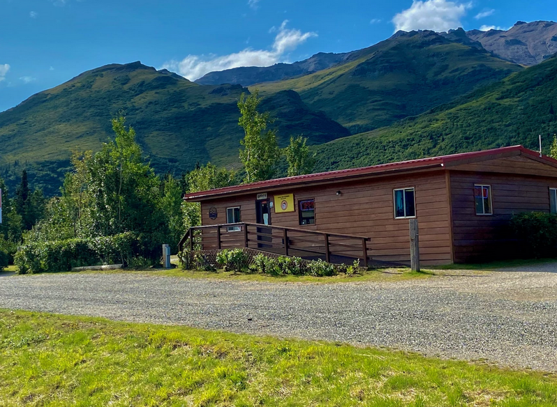
Denali RV Park and Motel offers the basic amenities such as free parking, free WI-Fi, and a self-serve laundry. They have full hookups and even have cable TV. It is kid-friendly and pet-friendly as well. They have sparkling clean restrooms and showers.
The common entry in Google Reviews I have noticed is that they have great customer service and an awesome gift shop with lower prices compared to souvenirs bought in the nearby town. Also, the RV park is a mere 14-minute drive to the Mount Healy Overlook Trail.
Sugarloaf Ridge, Alaska
Unknown to us from the 21st century, a sugarloaf was the usual form in which refined sugar was produced and sold until the late 19th century until granulated and cube sugars were introduced. It’s a mound of sugar that needs the help of a sugar nip to be broken into small usable pieces.
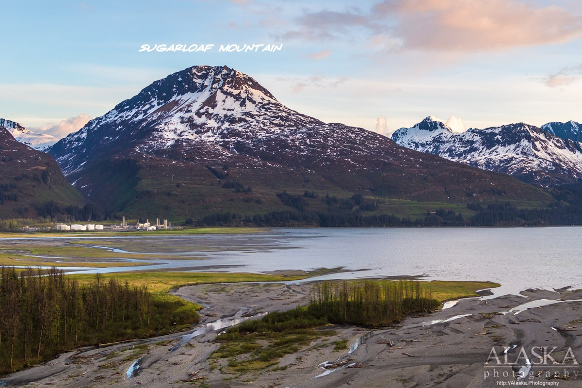
Sugarloaf Ridge is exactly like a sugarloaf. It is a steep, loose, rocky, windswept ridge that’s composed of little more than loose scree. It soars above the Nenana River valley and the greater entrance of Denali. The eight mile round-trip hike begins unceremoniously at the end of a parking lot behind the Grande Denali Lodge in the most developed and commercialized area of Denali, the “Glitter Gulch”. It is called such because it is composed of a strip of restaurants, lodges, and gift shops.
You begin here, clawing your way through an especially thick brush depending on the season, with the rather difficult hike having a great forest setting all throughout. It soon climbs above the treeline rewarding you with spectacular 360-degree views of spectacular vistas. Just a thirty-minute walk from Glitter Gulch and suddenly you find yourself in the middle of the great Alaskan wilderness!
While it is Mount Healy’s neighbor, it may be possible to catch a glimpse of what was previously called Mount McKinley in the distance. That is if the weather permits and it is a rather clear day. The best time to visit Sugarloaf Ridge is from May until mid-September. Dall sheep are frequently seen in the trails. Speaking of animals, dogs are also able to use this trail.
While You’re There: An Insight on Denali National Park, Alaska
Denali is a name taken from the local dialect meaning ‘the high one’. It was formerly called Mount McKinley. As said earlier, climbing Denali is such a difficult climb that only half of those who attempt it reach its summit. Even if you could not conquer Denali, Denali National Park has a whole lot of mountains and trails for you to choose from. Views from these treks are nothing short of amazing! One option you could take is the Wonder Lake Trail. This trail is a two-mile hike on a well-maintained trail from the Wonder Lake Campground to the McKinley River.
Unfortunately, Wonder Lake Campground is a tent-only campground, this means no RVs are allowed. What you can do here is to park and settle at a nearby RV park then explore the trail that has its trailhead at the Wonder Lake campground. This trail is part of the historic route that climbers used to access Denali (Mt. McKinley). It gives you the feeling of what it must have been like to surmount ‘the high one’ as you walk in its shadow.
RV Park Near It: McKinley RV Park
McKinley RV Park is your no-nonsense RV park that carries your basic amenities. For just $31 to $35, you get Wi-Fi access, clean toilets and showers, and laundry service. Speaking of hygiene, they have a sewer and dump stations for RVs carrying composting toilets. They also have complete electricity and water hookups. It’s good to note that they have cell coverage here, too. There’s a playground for the littles and fire pits for campfires in the evening.
Mount Clark, California
A popular destination for mountaineers and rock climbers is Mount Clark and Clark Ridge, where the mountain it is located are both named in honor of Galen Clark, an early explorer and the first guardian of Yosemite National Park.
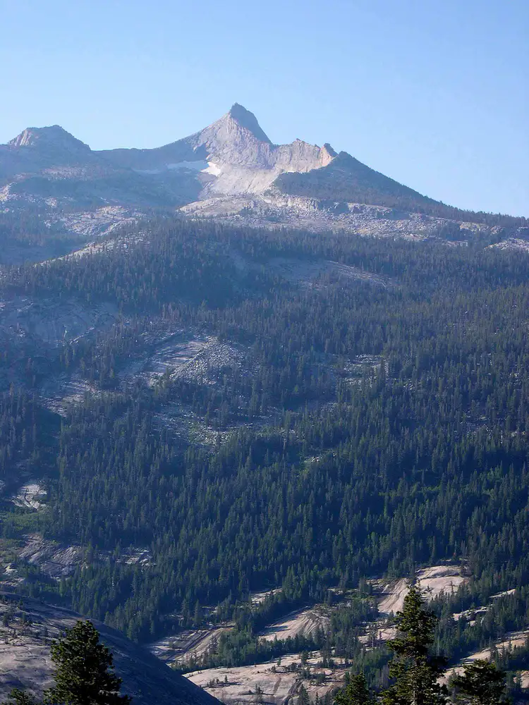
Before it received its present name, it was known as ‘Gothic Peak’ and then ‘The Obelisk’, meaning, ‘a stone pillar’. This is where the near Obelisk Lake got its name from.
Image source: summitpost.org
This 1,527-foot (3,513 m) granite peak in the sub-range of the Sierra Nevada has a number of easy scrambles. The peak has excellent rock quality, golden polish, and clean cracks. Hiking is usually done from May to October during fair weather. Before and after these months, the Glacier Point Road is closed past the Badger Pass ski area. One can still attempt to climb Mount Clark when the road is closed, but it adds about 10 miles to the approach. With snow on the ground, the already long approach becomes a very dangerous endeavor. In the early springtime, the Illilouette Creek rages and swells up becoming a significant obstacle to cross as there is no bridge.
Other Awesome Sites in Yosemite National Park
Although this blog focuses on the Rockies and other mountains, I couldn’t help but interject a few gems in Yosemite that might interest any mountaineer, rock climber, or generally any outdoor enthusiast.
Tuolumne Meadows
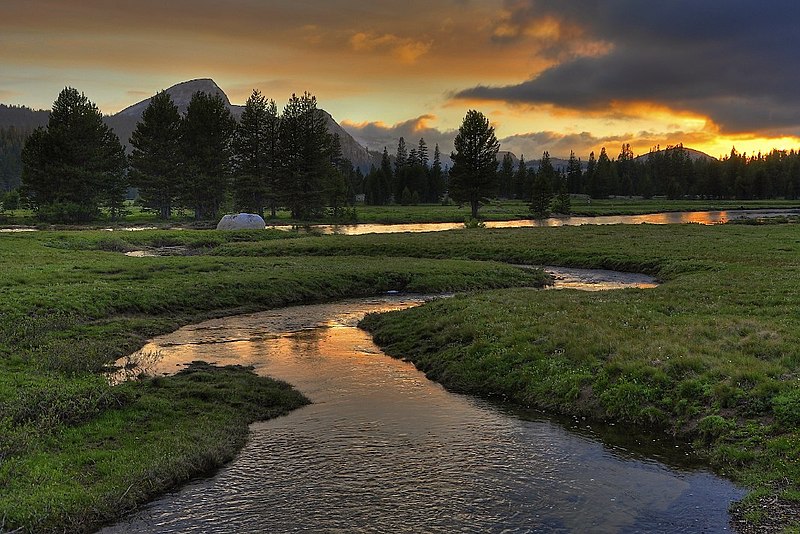
Tuolumne Meadows is a gentle rolling subalpine meadow studded with multiple domes in an area along the Tuolumne River in the eastern section of Yosemite National Park. Although a meadow, its approximate elevation is 8,619 feet (2,627 m). In the context of rock climbing, the term Tuolumne Meadows is also often used to describe a large portion of the Yosemite high country around the meadows, which is a popular destination for rock climbers.
Taft Point
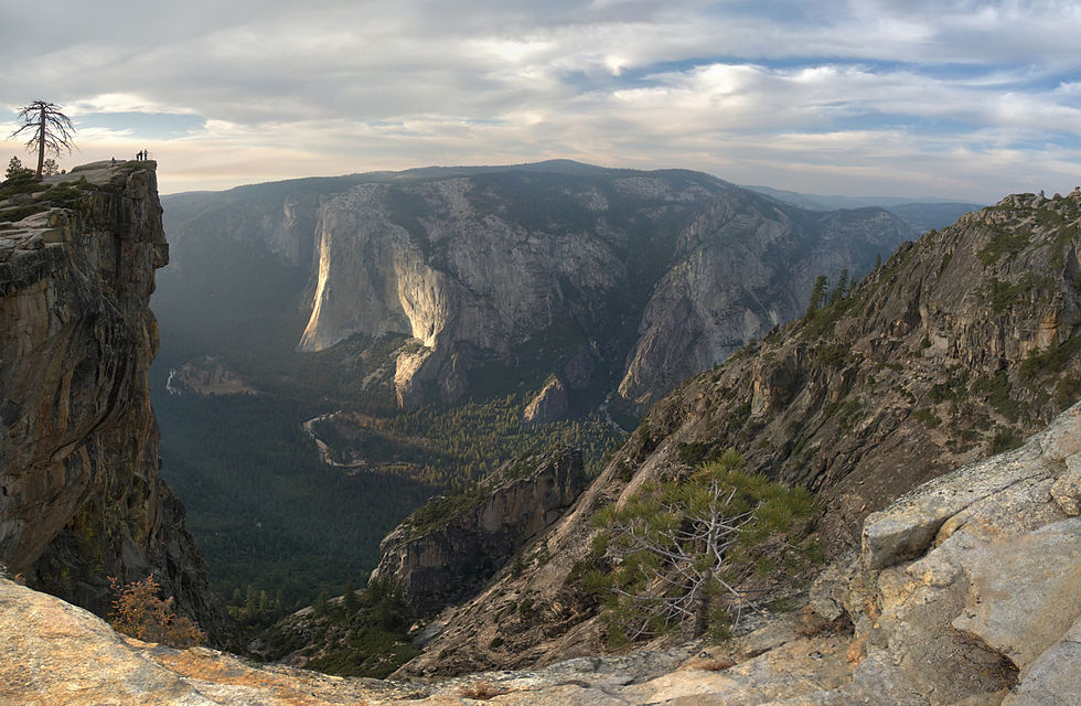
The main attraction of Taft Point is the giant fissures in the mile-high granite rock. The fissures are breaks and cracks in the mountain that drop directly down to the valley floor at some points. Although trails range from easy to challenging, Taft Point and The Fissures is a 2.3 mile heavily trafficked out and back trail that features beautiful wildflowers. It should be noted that The dropoff at Taft Point is steep, and a fall would be not just fatal- it’s a gruesome-kind-of-way fatal. The trail is best used from March until October.
RV Park in Yosemite National Park: Yosemite Lakes RV Resort
Yosemite Lakes RV Resort is equipped with complete RV amenities. It’s just a stone-throw away from an amazing waterfront, hence, the name. Fishing here is fantastic not to mention that it is a good place for trailer camping. It’s both pet-friendly and kid-friendly. According to some Google Reviews, their ‘website sometimes doesn’t work for reservations’. You can always use third-party booking apps to help you with this problem.
Lastly, camping is free and is allowed in most areas of the Yosemite Wilderness that surrounds Mt. Clark. All you would need is a valid Wilderness Permit for reservations. The permit costs only around $5.It is recommended that you call as early as six months before your trip as slots fill up fast.
Mount Whitney, California
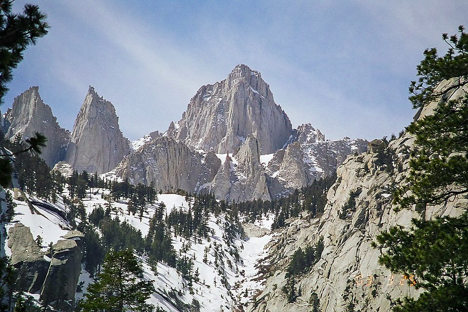
Mount Whitney in California is the tallest mountain in the 48 contiguous United States and the Sierra Nevada, with an elevation of 14,505 feet (4,421 meters). This mountain is a mountaineer’s home. It offers a variety of trails and scrambles perfect for the novice and intermediate hikers. The most popular route to the summit is through the Mount Whitney Trail, which starts at Whitney Portal. The hike is about 22 miles (35 km) round trip with an elevation gain of over 6,100 ft (1,900 meters). Hiking permits are always required. To prevent overuse of the trail, only a limited number of permits are issued by the Forest Service between May 1 and November 1.
Another popular hiking route in the area is the “Mountaineer’s Route”. This gully on the north side of the east face, first climbed by John Muir, is considered to be a class three scramble. The fastest recorded time to ascend this route to the summit and descend back to the portal is 3 hours 10 minutes, by Jason Lakey.
For fast hikers, the ascent can be done in about five hours, with about seven to eight hours for the average hiker. A slow pace may mean 10 hours to the top. Generally, the descent takes around two to three hours quicker. To get back to Whitney Portal before dusk in the summer at 8 pm, it often requires starting before sunrise. The steep eastern side of the mountain also offers a variety of climbing challenges.
Mount Whitney is located in East-Central California, on the boundary between California’s Inyo and Tulare counties. It lies 84.6 miles (136.2 km) west-northwest of the lowest point in North America at Badwater Basin in Death Valley National Park at 282 feet (86 m) below sea level. The west slope of the mountain is encompassed by Sequoia National Park and the summit is the southern terminus of the John Muir Trail which runs 211.9 miles (341.0 km) from Happy Isles in the Yosemite Valley. The east slope is inside the Inyo National Forest in Inyo County.
RV Site Near Mount Whitney: Boulder Creek Mobile Home and RV Park
Boulder Creek Mobile Home and RV Park proves to be more than your basic RV park. It has free WiFi, laundry service, and access to clean showers and restrooms. The park is also equipped with full hookups, including water, electricity, and even propane refills. It has a storage for rigs and a mini Mart close by for you to fill up with essentials. It also has a pool and a spa!
Mount Elbert, Colorado
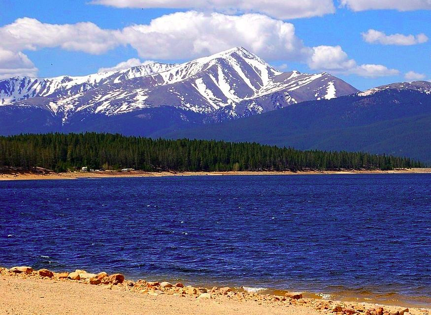
Known to be the highest summit of the Rocky Mountains of North America and the highest point in Colorado, this ultra-prominent 14,440-foot (4401.2-meter) fourteener is the highest peak in the Sawatch Range and the second-highest summit in the contiguous United States after Mount Whitney in California. Mount Elbert is located in the San Isabel National Forest, 12.1 miles (19.4 km) southwest of the City of Leadville in Lake County, Colorado.
As prominent as it is, Mount Elbert is often referred to as the “gentle giant” that tops all others in the Rocky Mountains. The mountain was named in honor of a Colorado statesman, Samuel Hitt Elbert. He was active during the formative period of the state of Colorado and served as Governor of the Territory of Colorado from 1873 to 1874.
Seeing that it’s called a ‘gentle giant’ and only the second highest mountain second only to Mount Whitney, it is easy to underestimate how challenging this trail really is. This 10.3-mile hike will take you around 6-7 hours to complete. The first heavily-trafficked half takes you through a beautiful pine forest. The second stretch goes above treeline and over a terrain that almost looks like the ones you see in the moon landing clip. The elevation during the ascent might cause altitude changes.
On the last mile of the hike, you get to be introduced to the ‘false summit’ which is a steep incline that almost looks like a wall. The actual summit requires yet another climb. Yes, climb. This terrain calls for a climb, as the term ‘hike’ wouldn’t cut it anymore. After the grueling climb though, one is rewarded a majestic panorama that was well worth all the effort.
RV site near it: Elbert Creek Campground
Elbert Creek Campground is a first-come, first-served campground adjacent to the Mount Elbert and Mount Massive Trailheads at 10,000 feet. They provide complete water and electricity hookups. Other amenities include picnic tables, fire rings, and vault toilets. High altitude sickness may occur at this altitude.
As to campground fees, they collect $15.00 per site for overnight camping. This includes two vehicles or one RV per site. An additional $6.00 is collected for a third vehicle. It only costs $7.00 for use of the campsite if not camping overnight.
Conclusion
Going mountaineering with your RV is a lot of fun but requires a little planning. Taking note of available RV parks near your destination is key to a great rocky mountain RV trip. These trips are best enjoyed with friends and family as there is danger going into the wilderness alone. Most importantly, always make safety your priority when deciding to go on mountain trips and stock up on water, energy food, and warm sweat-wicking wind-breakers beforehand.


